

The pretty village of Stainforth in the western Dales is set amongst limestone country but this walk includes two lovely but very different waterfalls.
Stainforth Falls are well visited, and easy to access on the River Ribble but Catrigg Force is a hidden away mountain gem.
Start the walk in the village of Stainforth, there is a car park and toilets. Stainforth is a picture perfect village with St Peter’s Church in particular worth exploring. Take the path under the road (B6479) and beside the river in order to visit Stainforth Falls.
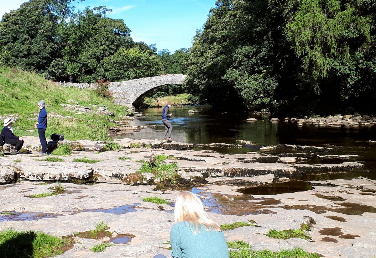
The path climbs over the train lines via a bridge (the famous Settle to Carlisle railway) before meeting a quiet road and dropping to the River Ribble. Cross the pack horse bridge and turn immediately left towards the cascading waterfalls. It is an idyllic spot to spend some time.
The flowers are out and you may find some intrepid swimmers jumping in to the deep pool. Return to the car park (starting point) the same way.

Follow the road in to the village from the car park, to the Craven Heifer pub. Follow the road opposite and bend left past more lovely Yorkshire stone buildings. The road peters out in to a track as it exits the village, a signpost pointing uphill towards Catrigg Force.
The initial steep lane soon flattens to a more gradual and pleasant gradient as it heads parallel but above the stream to the left.
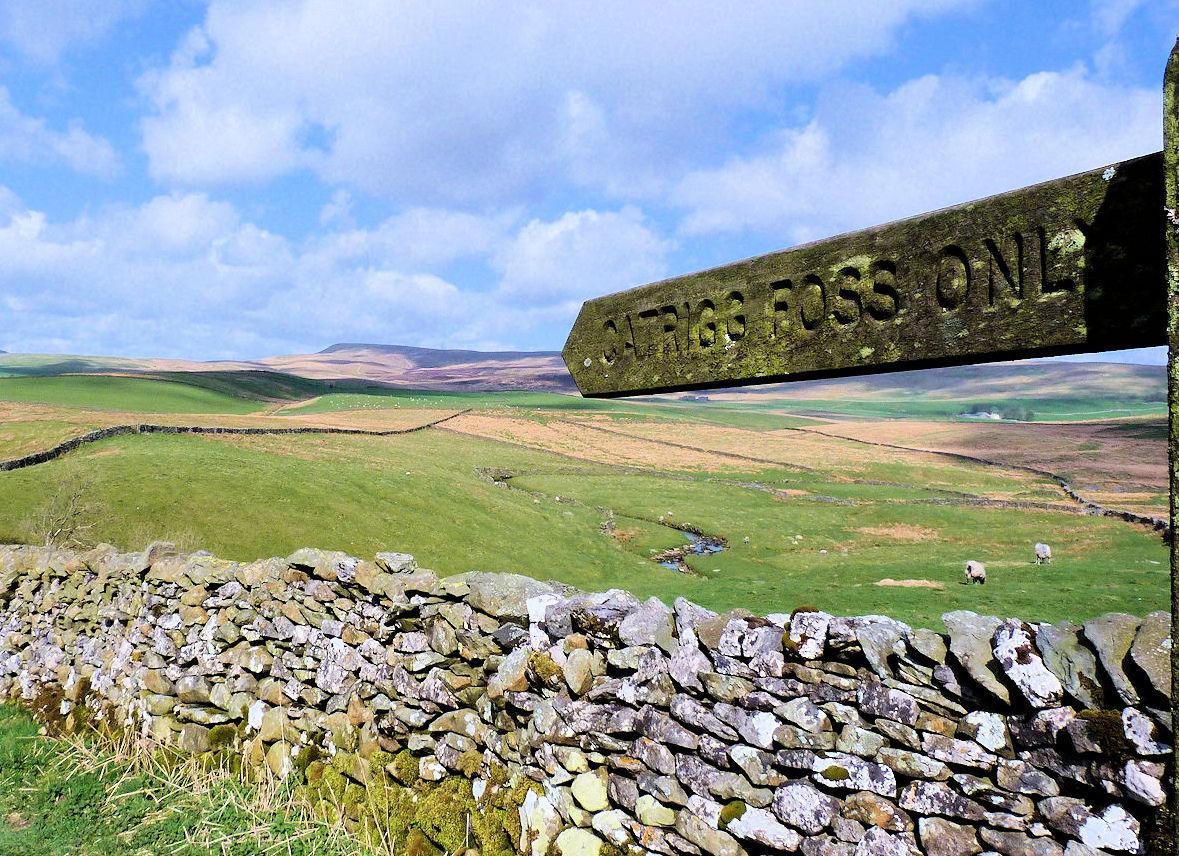
After following the track for just over half a mile a gate will bar your way and a signpost to the left will point down towards Catrigg Force.

Take the path. After 20m a pleasant open picnic spot marks the top of the falls whilst to the left a stile leads in to some thick woodland. The path here drops down to the idyllic Catrigg Force, a single 7m waterfall plunging in to a deep and secluded pool.
In spate this is a remarkable site, one of the best in the Dales. Fifteen years ago the waterfall and area was put up for sale and the local paper described it as “One Dales beauty spot, no mains supply but plenty of running water. Price £35,000.” The composer Edward Elgar was just one of many big fans of the falls.
Return via the picnic spot to the gate with the signpost and carry on over a large open field along the farm track. The views now become the outstanding feature of the walk. All Three Peaks of Yorkshire (Pen-y-Ghent, Ingleborough and Whernside) are in view as well as many other outcrops of pale limestone rock, rocky scars and shake holes where the land has sunk in to a crater shape.
The track passes through another gate before bending right and arriving at the lonely farm of Upper Winskill. It may be lonely but the views are extensive.
A path skirts the farm for 100m south west towards Lower Winskill Farm. The path turns west and then north west towards an escarpment. The limestone escarpment is typical of the area, the limestone bedrock drops off after water and ice erosion sheers off the rock face. The path passes easily down the scar, through some pleasant woodland before entering the outskirts of Stainforth village.
Jonathan runs Where2walk, a walking company based in the Yorkshire Dales. He has published three books on walks in the Dales, The Yorkshire 3 Peaks, The Dales 30 mountains and the new Walks without Stiles book. All (and more) are available direct from the Where2walk website. Book a navigation training day in Long Preston (two levels, beginners or hill skills). Where2walk.co.uk also features hundreds of walks across Yorkshire and beyond, from easy strolls to harder climbs.
Walk facts:
Distance: Roughly 3.5 miles.
Height to climb: 180m (600 feet). Initial climb is steep.
Start: SE 821673. There is a pay and display car park in Stainforth.
Difficulty: Easy walk on good tracks throughout. The path in the woods to Catrigg Force can be slippy.
Refreshments: The Craven Heifer in Stainforth is a traditional Yorkshire pub.
Be prepared: The route description and sketch map only provide a guide to the walk. You must take out and be able to read a map (O/S Explorer OL2) and in cloudy/misty conditions a compass. You must also wear the correct clothing and footwear for the outdoors. Whilst every effort is made to provide accurate information, walkers head out at their own risk.
Please observe the Countryside Code and park sensibly.


Comments: Our rules
We want our comments to be a lively and valuable part of our community - a place where readers can debate and engage with the most important local issues. The ability to comment on our stories is a privilege, not a right, however, and that privilege may be withdrawn if it is abused or misused.
Please report any comments that break our rules.
Read the rules here