

AS we told a fortnight ago, a copper railway once hugged the southern bank of the River Swale in Richmond, leading from Green Bridge round to an old mine. A causeway made of massive grey slabs of stone – chert – can still be followed just above the usual water level.
“A few years ago when Richmondshire District Council was tidying up the chert flags, they found some iron rails which showed that it had been a 12-inch gauge railway,” says Richmond historian Jane Hatcher. So it was a narrow gauge railway with an LP record or a large pizza able to fit snugly between the tracks, and the tubs of copper ore were pushed by hand along it.
“The rails had survived where there was a drop from the level of the mine onto a slightly lower level to get the tubs to Green Bridge. The rails will be buried again now as the hillside slowly slips onto it all!”
The entrance to the copper mine is now gated and locked. “All the kids of my era knew about it as you could walk into it,” says Chris Delf. “The limestone was coloured a beautiful green from leaching copper carbonate.
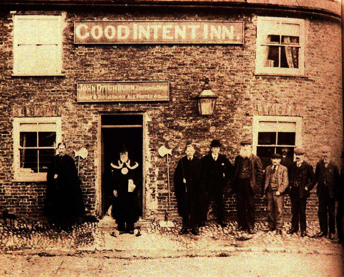
“The house beside Green Bridge used to be a pub called The Good Intent. My maternal grandfather grew up there.”
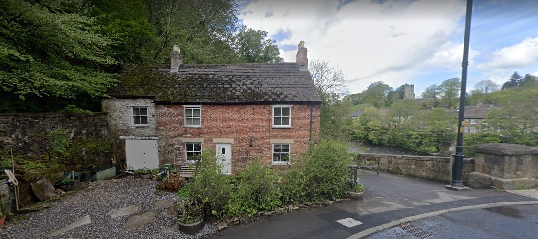
The Good Intent, at the foot of Sleegill, was once a pub. On the right, is the ramp down from Green Bridge to the copper railway. Picture: Google StreetView
A wide ramp was constructed beside The Good Intent so that the tubs could be pushed up onto the Sleegill road.
The Swale at this point is the boundary between the parishes of Richmond and Hipswell, which means that The Good Intent was the first pub on the Hipswell side. The pub’s regulars used to mock all of the fancy ceremonies that Richmond enjoys by choosing someone from their bar to be the Mayor of Sleegill. They’d dress him up in a posh hat with a cheap metal chain around his neck and they gave him a parchment which enumerated his very important duties.
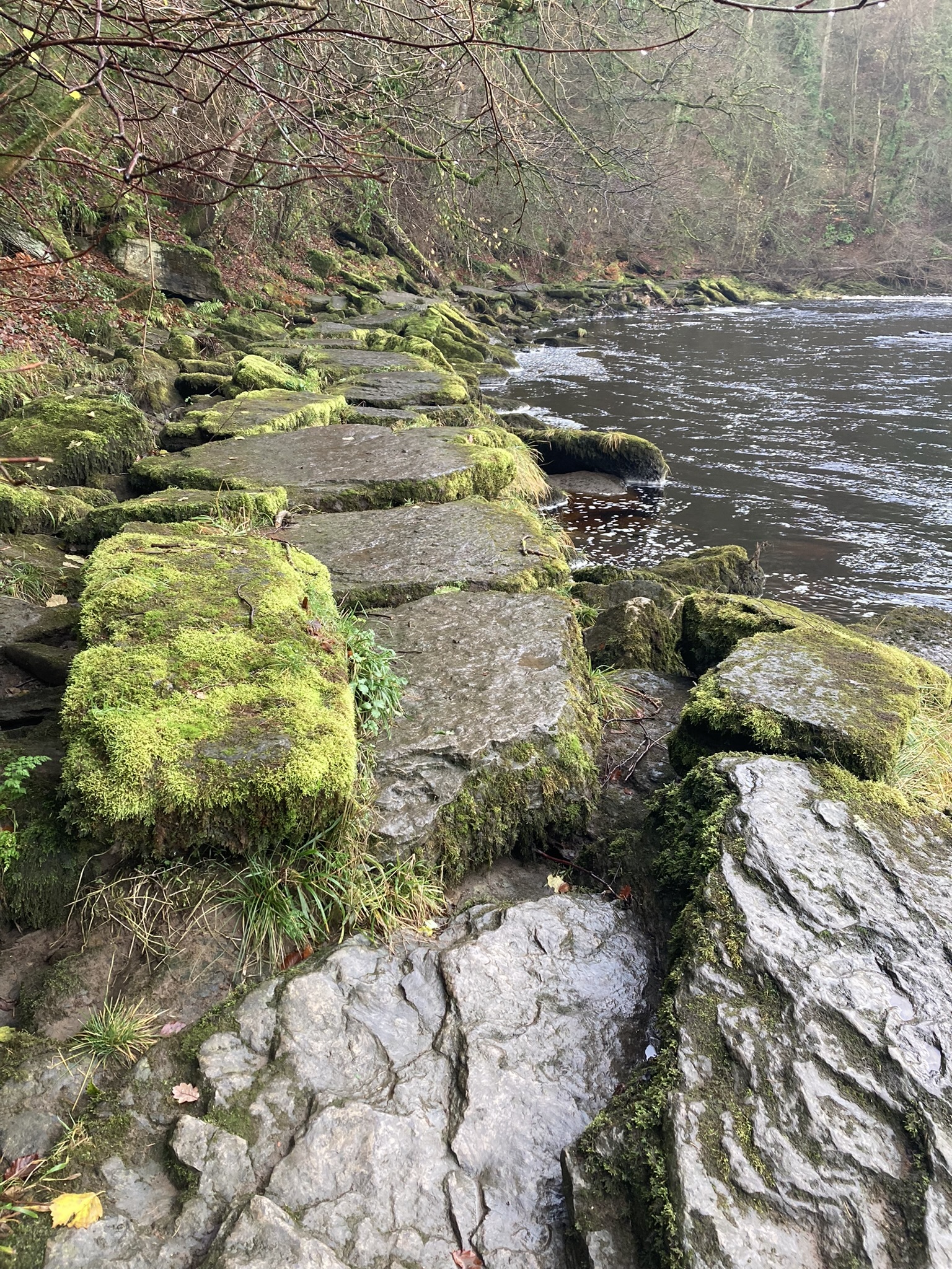
The remains of the chert causeway on which ran the copper railway of Richmond
The Good Intent is now a private house having closed as a pub in 1914. Perhaps the closure of the copper mine in 1912 was the final nail in The Good Intent’s coffin as the miners must have been good spenders – after all, if you’d spent your day pushing a tub laden with ore for a good half-a-mile around the riverside and then up the steep ramp to the road, you’d need a beer or two to help regain your strength.
READ MORE: The ancient Richmond tramway which led to a network of tunnels
THE copper miners’ ore was collected at the top of the ramp by ponies and pulled over Green Bridge to the station.
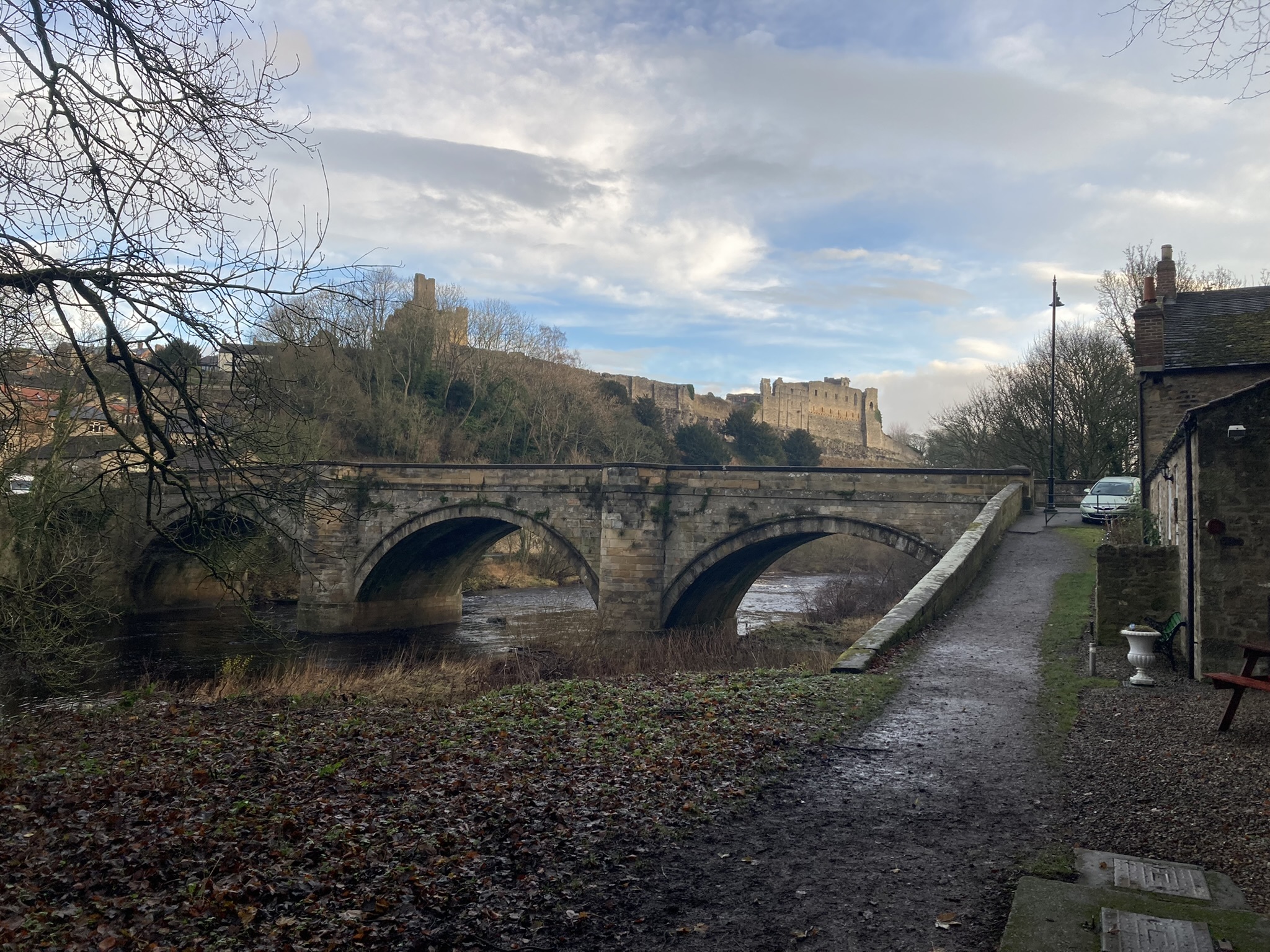
The copper railway ramp up to Green Bridge, with the Good Intent on the right
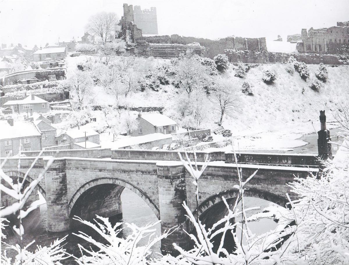
In centuries past, Green Bridge was Richmond’s only crossing of the Swale. It was a key piece of infrastructure on the Richmond to Lancaster turnpike road, construction of which started in 1751. The 58-mile road, which actually started at Brompton-on-Swale, took 22 years to complete, and involved building a new road – Sleegill – up from Green Bridge to Holly Hill. Sleegill was regarded as being a gentler ascent than the old Boggy Lonen. Given that Sleegill today defeats all cyclists except those with the lung capacity of Bradley Wiggins, Boggy Lonen must have been incredibly steep.
The Great Flood of November 1771 washed away the medieval, four-arched bridge – at low water, its piers can still be seen upstream of the existing bridge.
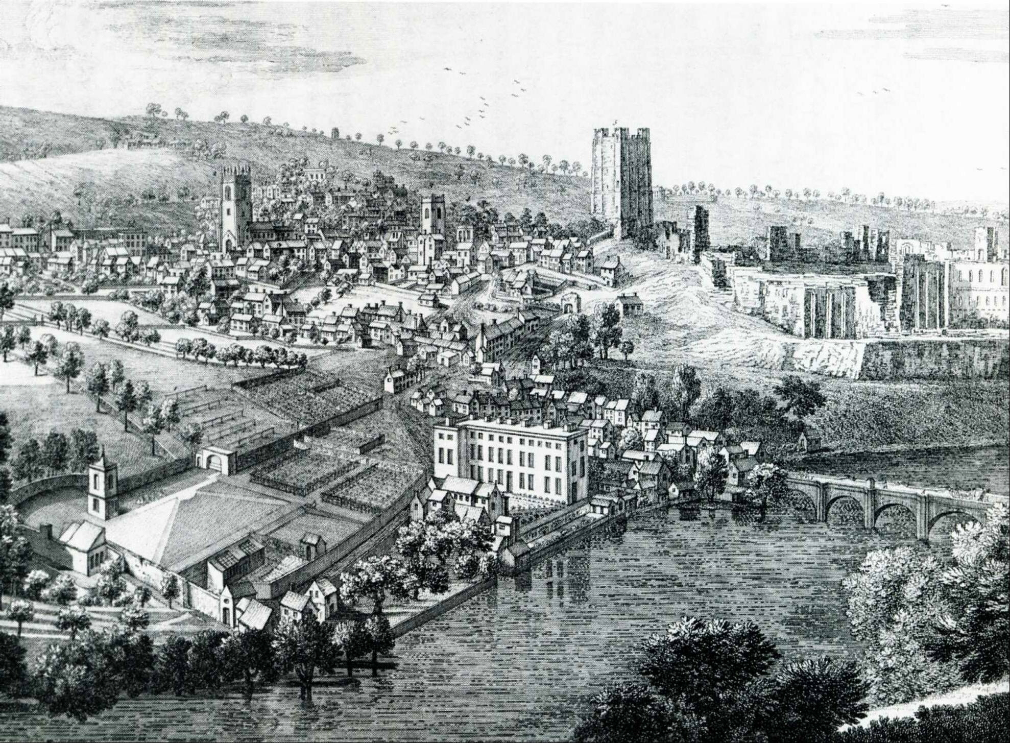
Richmond in 1749 with the castle dominating the background but the 15th Century Green Bridge, with four arches, at the bottom right. It was washed away in 1771
John Carr, the Yorkshire surveyor whose bridges still carry countless cars every day in the county, designed the replacement, but the two authorities whose boundaries met in the middle of the river, couldn’t agree who should construct it.
So Richmond appointed Messrs Bennison and Walsh to build its half for £888, while the North Riding appointed John Parkin of Askrigg to build the Hipswell half for £899. Fortunately, the two halves met in the middle (it was not so fortunate for labourer Thomas Dunn who drowned during the construction), but if you stand in the middle, you will see that the Richmond side has four layers of stone on the parapet while the Hipswell side has three – the rival builders were not singing from the same hymn sheet.
The Richmond builders incorporated the names of their mayors, Henry Blegborough and Tristram Hogg, who wore the chain of office while the bridge was being built in 1788 to 1789, while on his half, Mr Parkin included a milestone which said Lancaster was 56 and Askrigg was 18. Out of all of the little settlements that the turnpike passed through as it climbed over 2,000ft to Ribblehead, it was good of Mr Parkin to single out his home village for mention on the milestone.
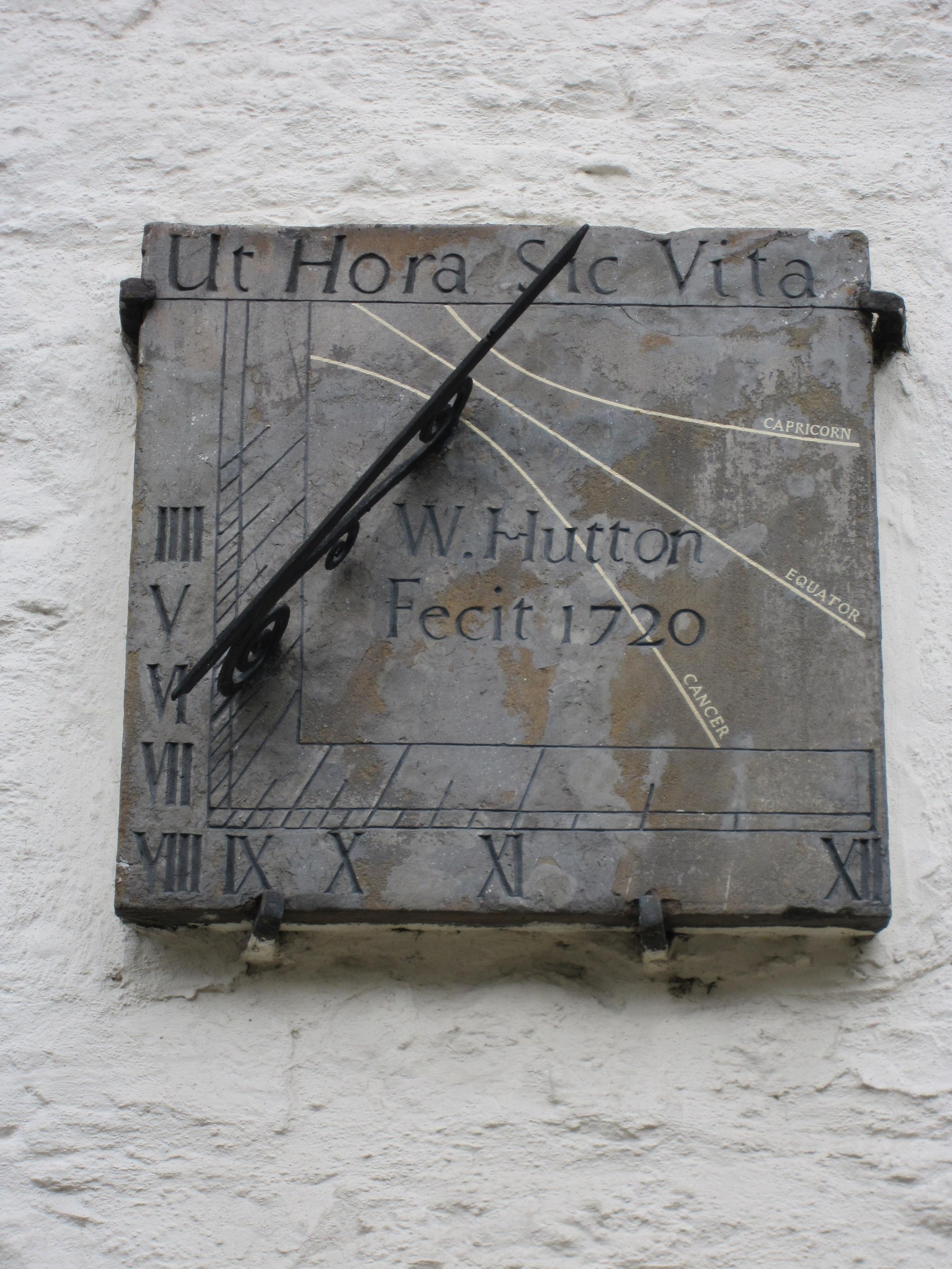
FINALLY, as we cross over Green Bridge into Richmond, we are confronted by one of our great fascinations: sundials.
The house on the corner of The Green (which, of course, gives its name to the bridge) and Bridge Street (which, of course, takes its name from the bridge) has two dials: one facing south, the other facing east. This is the only known double dial in North Yorkshire and the North East.
The east face, only telling the time until noon, of the rare double sundial on Richmond Green
The east dial is dated 1720 and tells the time to noon. It bears the legend "Ut hora sic vita" – "Life is as an hour" (probably the most common sundial motto in the land).
The south, more conventional, dial is dated 1721 and bears the name of the man, William Hutton, who made, or "fecit", both dials. He lived in the corner house and must have had too much time on his hands.
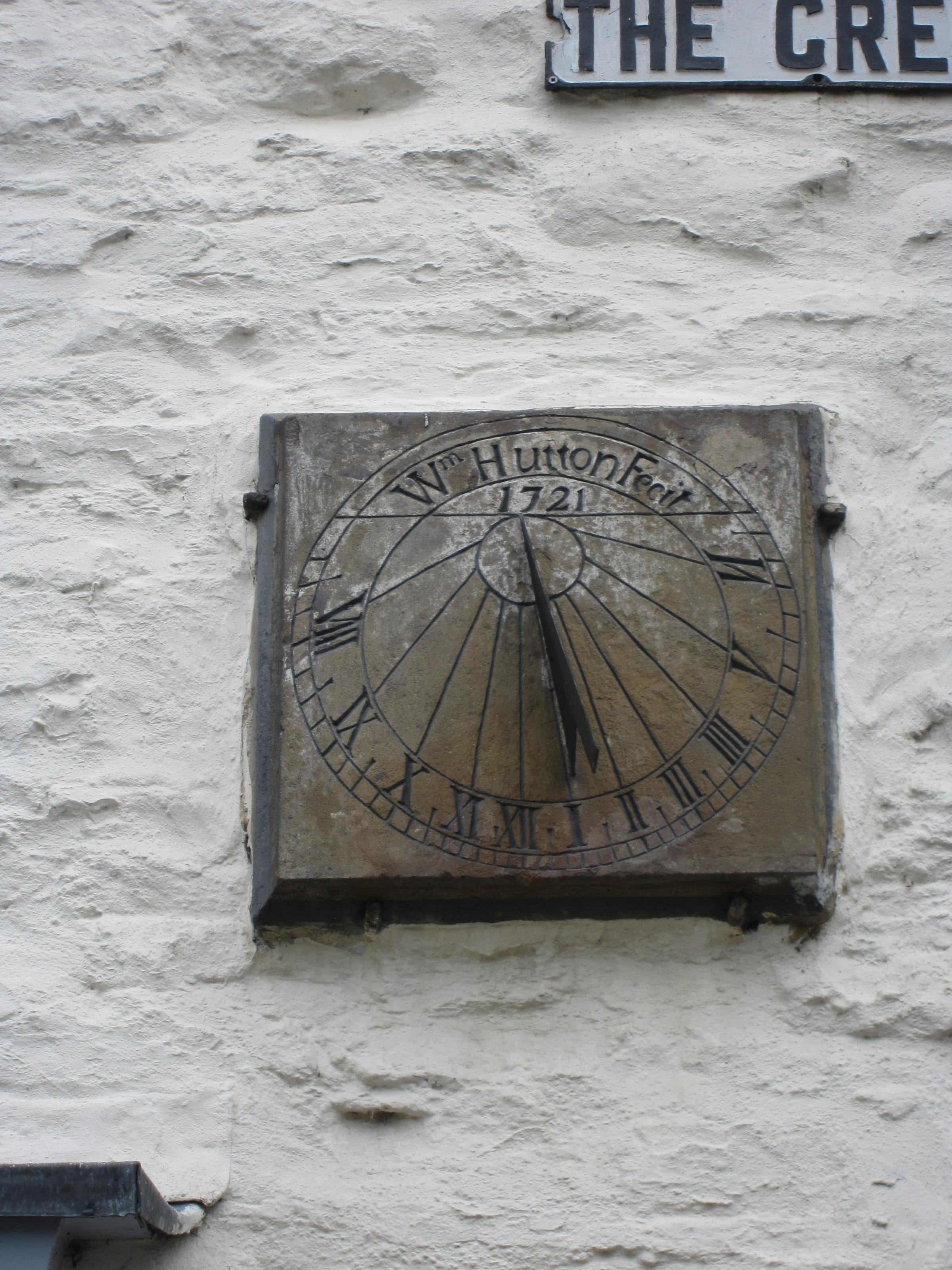
The south face of the rare double sundial on Richmond Green
The dials were restored in 1998 by Professor Alan Smith of Manchester.
- If you can add to any of the items in today’s column please email chris.lloyd@nne.co.uk


Comments: Our rules
We want our comments to be a lively and valuable part of our community - a place where readers can debate and engage with the most important local issues. The ability to comment on our stories is a privilege, not a right, however, and that privilege may be withdrawn if it is abused or misused.
Please report any comments that break our rules.
Read the rules here