

AERIAL photos of the region, which date as far back as 1945, have been made available by Cambridge University.
The collection of previously hidden photograph’s were taken by RAF pilots shortly after the Second World War.
For several decades, the pictures had been kept by the university, only available for staff, students and researchers to use.
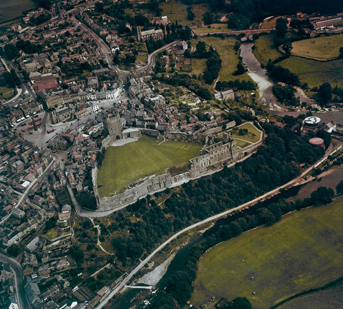
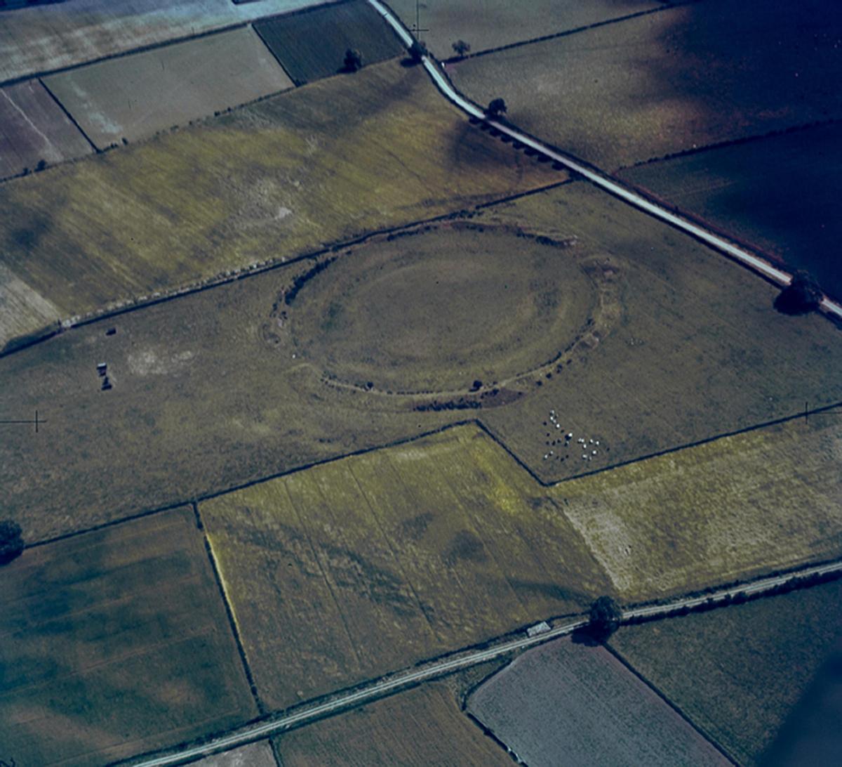
But among the collection, two images of a recovered North Yorkshire have surfaced.
Aerial views of Richmond and Thornborough show what life was like after the war.
The images were taken under the instruction of Cambridge archaeologist JK St Joseph.
From there, St Joseph borrowed RAF planes, accompanied by their pilots, in his mission to photograph the entire country.
Dr Robert Bewley, an Oxford academic, said: "St Joseph became a pioneer of air archaeology after his work analysing RAF reconnaissance photos during World War Two, and came to realise there was a huge opportunity to use similar photos in archaeology and geology.
"He chose former RAF bomber pilot Flight Lieutenant Derek Riley - who had been an archaeologist before the war - to take him on his first trip.
"In those days you could fly where you wanted with few restrictions and that's exactly what they did."
Around 1,500 photographs out of almost 500,000 have been published online.
Professor Martin Millett, a Cambridge archaeologist who has researched the collection of images, said: “Anyone can go to Google Earth and look at modern satellite imagery.
"But this is an historical Google Earth that lets you travel back through time to a Britain which no longer exists.
"In this first batch of photos – some very early colour photography, we have picked some of the most beautiful images documenting the changing face of cities and towns in the UK."


Comments: Our rules
We want our comments to be a lively and valuable part of our community - a place where readers can debate and engage with the most important local issues. The ability to comment on our stories is a privilege, not a right, however, and that privilege may be withdrawn if it is abused or misused.
Please report any comments that break our rules.
Read the rules hereLast Updated:
Report this comment Cancel