
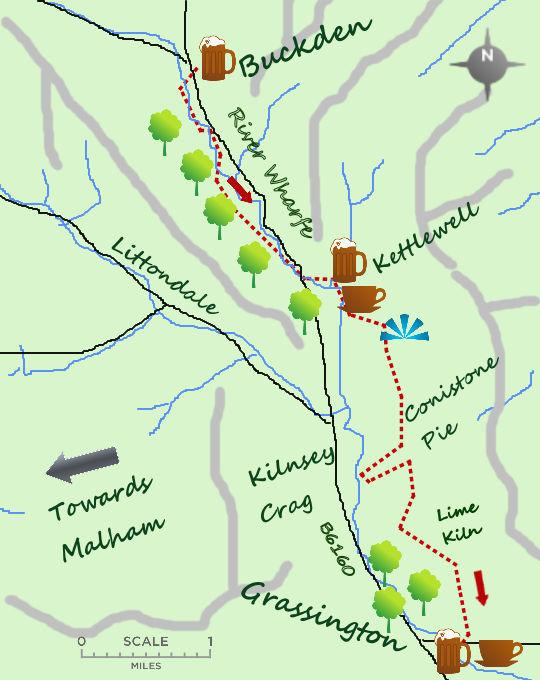
LINEAR walks are often the most enjoyable. This is certainly the case in Upper Wharfedale where, making use of the Dalesbus, you can enjoy some delightful riverside walking followed by a short climb and a longer stroll through some lovely limestone country.
I do believe that using a bus (or train) enhances a walk, particularly when it takes you to the far point of your proposed walk and you can avoid any repetition by heading back to your start. Leaving the car in Grassington the 72 heads regularly up the valley to Buckden taking just over half an hour to arrive. It is a pleasure, as a driver, to be able to look out on the countryside instead of concentrating the road.

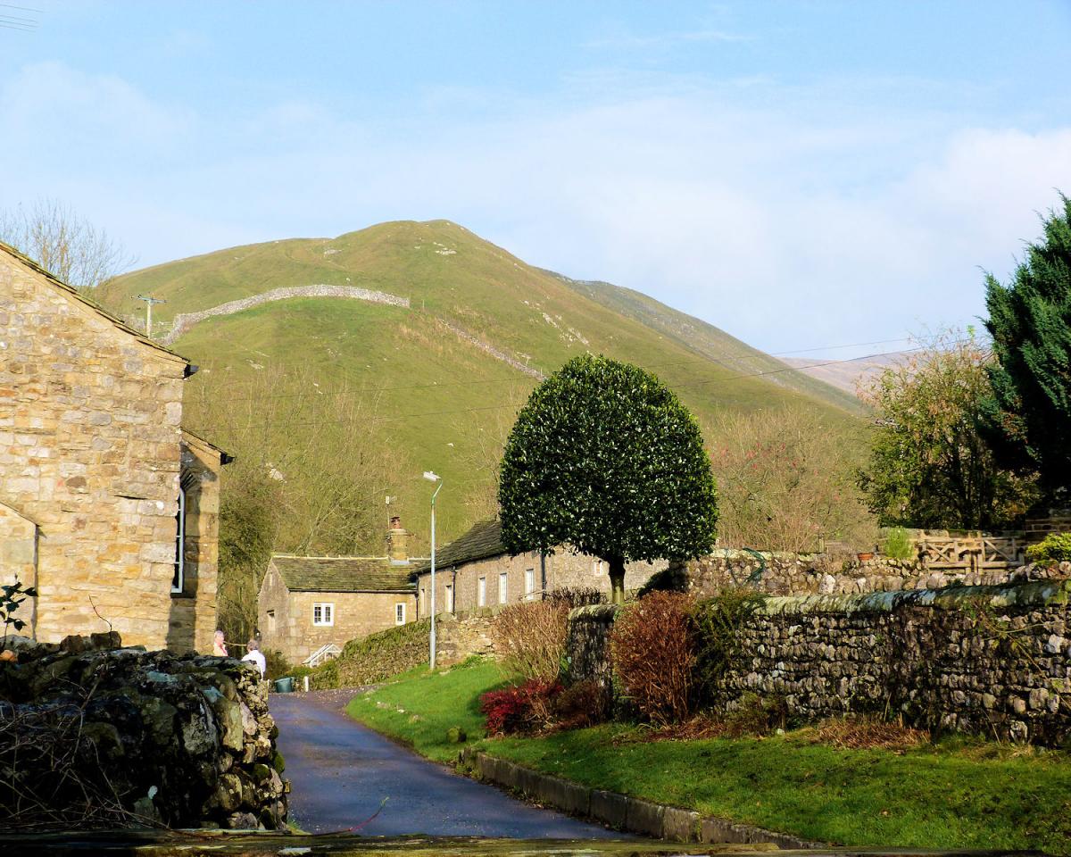
Buckden is a pretty village at the head of Wharfedale, from the car park cross the river and just over the bridge turn left on to a riverside path. For the next 4 miles the path follows the west bank of the River Wharfe all the way to Kettlewell. The glacial silt has left a rich but often wet valley bed, perfect for bird watching; on my last visit I was able to spot a curlew, lapwing and even viewed a heron gracefully exiting the river. After 2 miles a bridge leads over to Starbotton, one of the most attractive and unspoilt villages in the Dales, well worth a 10 minute detour.
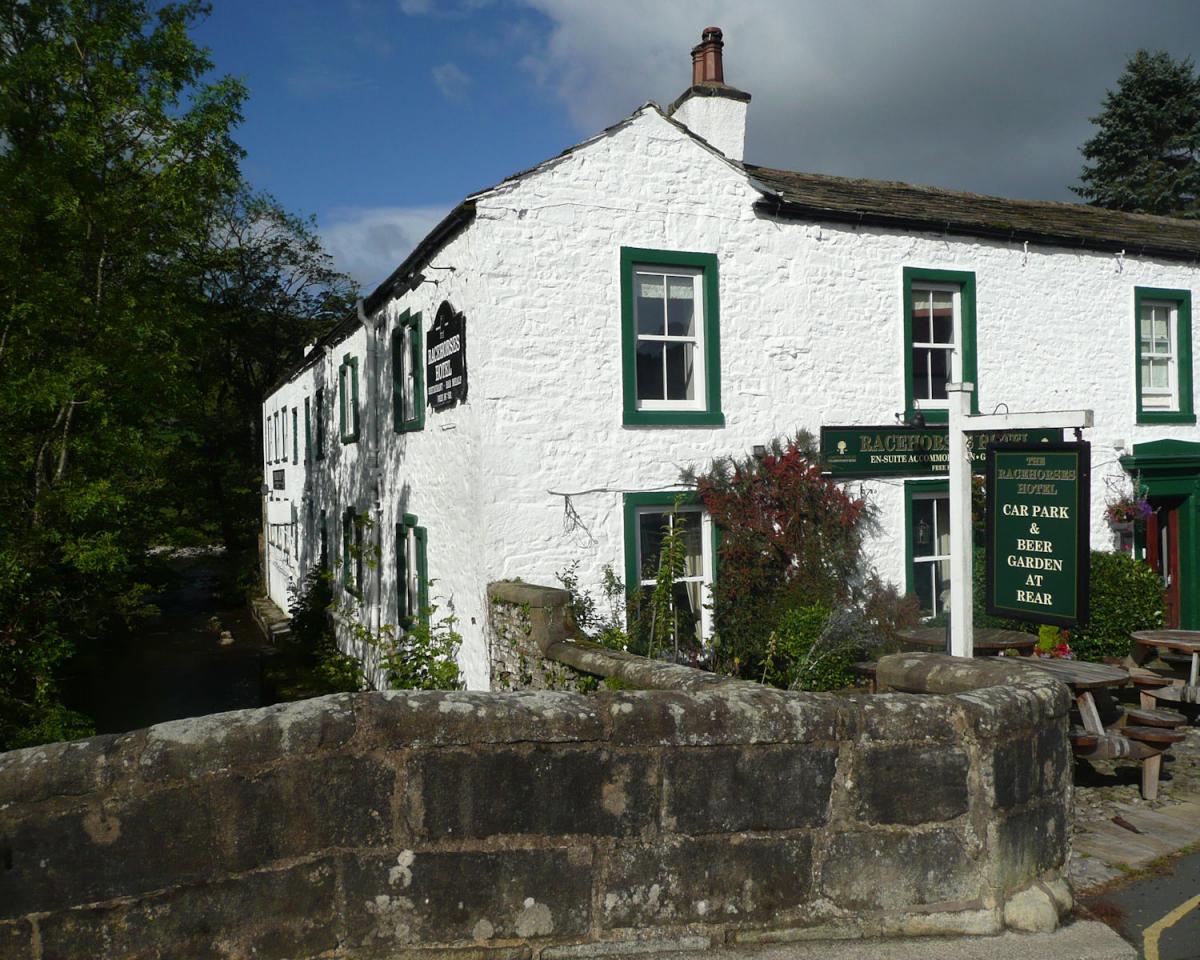
Another village which is worth exploring is Kettlewell which is slightly larger than Buckden and Starbotton and has a fine history stretching back over 1,000 years. In particular the village has a cotton mill, 5 pubs and 3 blacksmiths! Today it is more geared for us walking types and has a few pleasant cafes and pubs if you need to partake this early in the walk. Exit the village on the quiet road opposite the bus stop and keep to the west side of the river. Follow this road for nearly a mile, passing the popular religious retreat at Scargill House, a spectacular looking building.
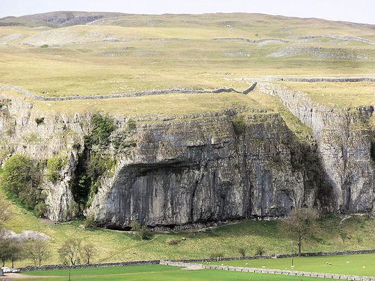
The hard graft on this walk comes next, a track climbing 100 metres up the fellside through open fields and finally in to the woods. There is a gate just before emerging from the woods, take the path to the right and do not continue climbing directly up the hillside. For the remainder of the walk keep heading just east of south on an obvious path, enjoying the continually wonderful views of Wharfedale, Littondale and some of the best limestone scenery the Dales can offer. This is at its best at the Conistone Pie, a distinctive outcrop that can be seen for miles around. Across the valley to the right is Kilnsey Crag, an overhanging cliff popular with local climbers.
Two more striking features arrest the attention as you walk the 5 miles from the woods to Grassington village. The first can be seen soon after passing Conistone Pie, a dry deep valley known as ‘the Dib’ leads steeply in to the dale below. Further along the path passes an impressive limestone kiln, one of many in the area. The limestone was heated in the kiln and quicklime was produced, the lime diluted and spread in the nearby fields to improve the fertility of the soils for agricultural purposes. Look to your left and 2nd kiln is visible on the hillside. From the kiln the track carries on south until the high land ends and the village of Grassington lies below.
Jonathan Smith runs Where2walk, an outdoor business in the Yorkshire Dales. He has written his own book, the “Dales 30” which describes the highest mountains in the Dales. He also runs 1 Day Navigation Courses for Beginners and Intermediates. Learn a Skill, Climb a Hill Weekends. To find out more details on any of the above and details of many more walks in the area visit where2walk. co.uk.
WALK FACTS
Distance: Roughly 11 miles.
Height to Climb: 230m (750 feet)
Start: SE 003637. The car park in Grassington where the bus also leaves from. Check the Dalesbus.org website for up to date bus times.
Difficulty: Medium. Quite a long walk but straightforward and easy to follow.
Refreshments: Grassington has a good range of places to eat and drink, as does Kettlewell earlier in the walk.
Be Prepared: The route description and sketch map only provide a guide to the walk. You must take out and be able to read a map (O/S Explorer OL2) and in cloudy/misty conditions a compass. You must also wear the correct clothing and footwear for the outdoors. Whilst every effort is made to provide accurate information, walkers head out at their own risk.
Please observe the Countryside Code and park sensibly.


Comments: Our rules
We want our comments to be a lively and valuable part of our community - a place where readers can debate and engage with the most important local issues. The ability to comment on our stories is a privilege, not a right, however, and that privilege may be withdrawn if it is abused or misused.
Please report any comments that break our rules.
Read the rules here