
I WAS left behind for this walk so me (unwell) and the dog hit the sofa to sulk and doze while my navigator Victoria Ellis headed out for Slingsby on a lovely late summer’s day.
She left innocent of the Slingsby Serpent, a tale I learnt from The Spirit of Yorkshire by the authoritative J and R Fairfax-Blakeborough.
Apparently the serpent was a mile long and lurked in a hole “three yards broad” a half a mile from town and fed “on the prey of passengers”.
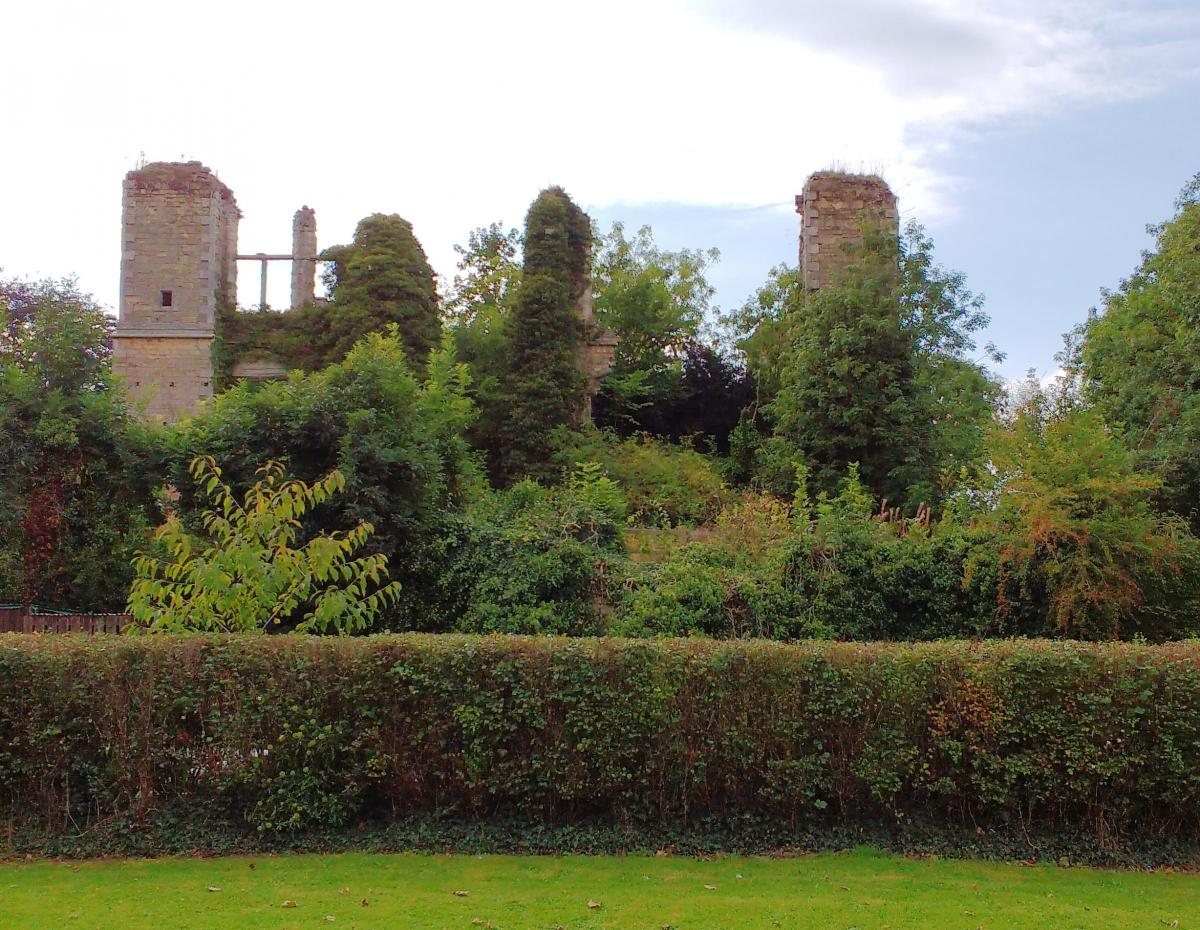
First up, I know she must have passed the Grapes Inn that has acquired a good reputation but, sober as a navigator, instead she had a gander at the village’s castle, a ruin but not the sort lovingly tended or open to the public.

The gaunt and overgrown stonework towers high and unsafe; “at risk” says English Heritage and it is fenced off from the public – and perhaps this is fitting as the place was never lived in.
Half a mile from Slingsby she was on the climb, a mere 200 feet that took her up to the escarpment that is the main length of the walk, and then it seems she concentrated significantly on the last of the season’s brambles which were “large and sweet” and then for a mile or so on the prospects of her lunch at Hovingham.
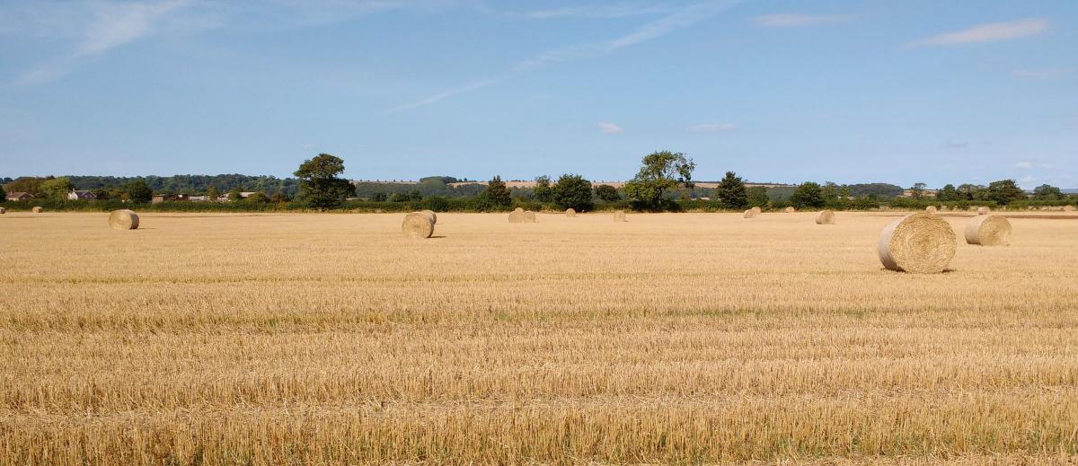
That’s not quite fair. She noticed the long prehistoric ditch that parallels the route. She reported a buzzard here, a kestrel there, the scent of honeysuckle and, when there were gaps in the trees, the lovely view over yellow stubble fields, and beyond them the moors.
And now and then she took a photo, on her mobile phone, as she had forgotten my camera.
There was a fresh gush of water in Wath Beck, the only stream, and the same water that graces the northern end of Slingsby at the end of the walk.
A descent to Hovingham brought clear views then lunch which she spent at a hairdressers cum café, which involved a lengthy sojourn reading the newspapers rather, thankfully, than getting a haircut that would have diminished any profit in the exercise.
After that it was an easy number, a direct stroll quite popular with the locals, across the flats of the fields that were peaceful after the harvest. Partly she walked a disused railway line, and by a bench is a plaque that informed that this is now part of the Fryton Millennium Heritage Trail, and was once part of the Thirsk and Malton branch line of the North Eastern Railway.
It’s a pity that Dr Beeching, he who took an “axe” to the railways, wasn’t a keen rambler, or we might now have a network of railway walks or cycleways the envy of Europe. As it is, we best enjoy the bits.
Talking of which, near Slingsby there is a rare tree named the Mowbray Oak that is believed to be 550 years old.
DIRECTIONS
When in doubt look at the map. Check your position at each point. Keep straight on unless otherwise directed. (wm=waymark fp=fingerpost).
1 From The Grapes Inn, pavement, right to Church Lane, church, High Street, castle and left to The Green, right after village green. Cross main road (Castle Howard), uphill 200 yards, track on bend, uphill (fp Banks Wood/Howardian Hills AONB). At track end, left 25 yards then right between fields on grass.
2 Right to wood-edge path. Straight on a junction (4-way FP Centenary Way/Hovingham), cross track with barrier gates (fp).
3 Straight on into woods (4-way fp Centenary Way), gently downhill, stile/fieldgate (wm), 100 yard across field, bridge into wood, (fp),10 yards, gate (wm on far side), uphill.
4 At crossroads with felled area ahead, right (3-way fp) to good track, ignore side turns (3 wm posts and fp).
5 Right to road into Hovingham.
6 Path on right (sign) through Malt Shovel carpark, pass tennis court, grassy field-edge path. Footbridge and left (wm), right at field corner (wm), left at next corner, 10 yards, path on right through trees. Ignore track on left. Path becomes track. Cross dead-end road near Fryton to old railway line (sign), barrier gate, bridge and right into Slingsby.
FACE FILE
Distance: 7 miles
Terrain: Escarpment and plain
Difficulty: Easy
Refreshments: Inn at Slingsby, inns and cafes at Hovingham
Map: Ordnance Survey Explorer Series No 300, for Howardian Hills and Malton


Comments: Our rules
We want our comments to be a lively and valuable part of our community - a place where readers can debate and engage with the most important local issues. The ability to comment on our stories is a privilege, not a right, however, and that privilege may be withdrawn if it is abused or misused.
Please report any comments that break our rules.
Read the rules here